Off-roading, remote camping, overlanding: All these activities have calculated risks, and if unprepared, things can go sideways. However, you can mitigate the risk by ensuring you’re fully prepared. A recent 4WD trip through central Oregon proved that by being prepared for any situation, you can ensure safe travels—and even help others.
The Zukiworld Fall Classic
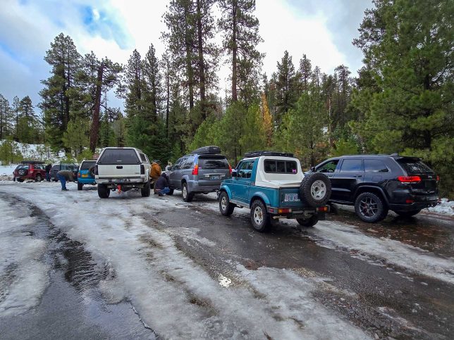
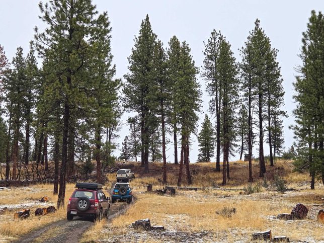
The Zukiworld Fall Classic is an annual late November gathering of Suzuki enthusiasts from around the Pacific Northwest. (While we don’t have a Suzuki anymore, we’re friends with many people who still do, and they let us crash the party from time to time in a Mitsubishi.) The event mixes exploring central Oregon’s hundreds of miles of trails with camping, camaraderie, and community.
It can be very cold at this event, so we bring cold-weather gear including down jackets, winter boots, knit hats, gloves and hand warmers, and an extra-warm sleeping bag setup. We had more than five gallons of water with us, multiple fuel canisters, and far more food than we’d need for just two nights of camping.
With the van prepped, Mercedes and I headed to Prineville to meet up with the others—a new location for the event. Fires this summer damaged our previous camp, so we had to move to a new place.
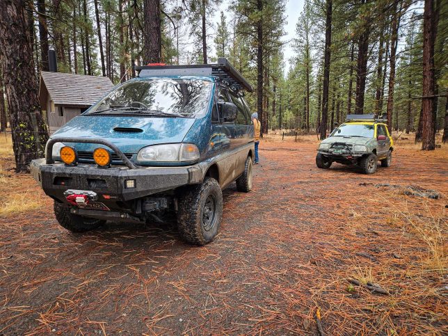
This year there were 12 vehicles at the event. Two gen-three Suzuki Grand Vitaras, two Suzuki Sidekicks, one gen-two Chevrolet Tracker, and one Suzuki Samurai equipped with a turbodiesel Isuzu engine swap. Non-Suzuki vehicles included a GMC Sierra, a Jeep Grand Cherokee, a Lexus GX, a new Ford Bronco, a Chevrolet Suburban, and us in our Mitsubishi Delica.
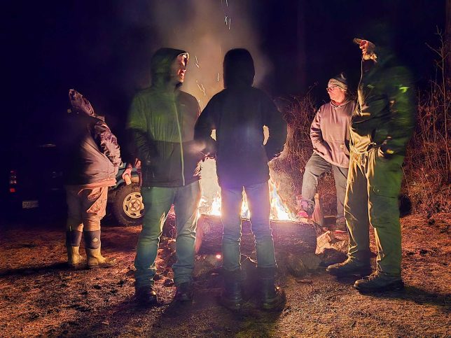
After driving to camp, people got a warm campfire going, two pop-up tents set up to keep us out of the intermittent pouring rain, and Eric, who runs Zukiworld.com, got the annual chili dump simmering. Despite the wetness, everyone was in good spirits and was looking forward to running trails the next day.
Exploring Ochoco National Forest & Crooked River National Grassland
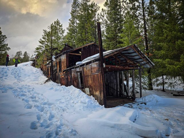
At 845,498 acres there’s lots to explore in Ochoco National Forest, including old mining sites, historic cabins, ranger stations, and excellent 4WD trails. Before the event, Eric even sent out a .KML GPS file showing some of them.
From the get-go, the trails were great. Some were wet and muddy. A few had multiple stream crossings, and much of the scenery was epic. We took a few wrong turns. Locked gates turned us around a couple of times. Time was passing faster than expected, but it wasn’t a worry. We were having a great time, and this is all part of exploring.
That afternoon, the group headed up Wolf Mountain, which has an elevation of 6,487 feet. Here, we’d encounter wet and heavy snow, affectionately referred to as “Cascade Concrete,” due to its high-water content and heavy weight. We were snow wheeling before we knew it.
The Wolf Mountain Melee
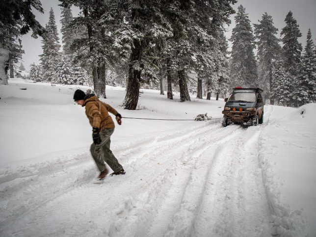
The farther up we went, the deeper the snow got. A few rigs got stuck, including our van. We deployed recovery straps and winches; it was all part of the adventure. We used our WARN ZEON 8-S winch and spooled out nearly all of its 100 feet of line plus a 25-foot extension to make it to a tree as an anchor. Later, we needed a tug out of some deep snow, as a whiteout started. Luckily, the snow squall was quick to pass.
It was now getting dark; we’d been out longer than anticipated, partially due to those locked gates and the slow going over the mountain. Vehicles with smaller fuel tanks, which had already used auxiliary fuel earlier in the day, were coming close to running out of fuel for a second time. But according to multiple GPS units, we weren’t very many miles from getting off Wolf Mountain and to a fuel station in Dayville.
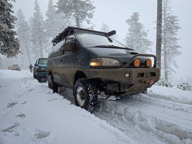
Rigs Were Running Low On Fuel
Over the radio, we learned Eric’s Sidekick ran out of fuel, and the second ‘Kick wasn’t far behind. Thankfully, Greg and his big GMC Sierra could tow Eric’s 4×4 down the mountain. But as we crawled down the snowy trail, others indicated their vehicles were running low on fuel now, too. We stopped to assess the situation; incredibly we had full mobile phone reception in this remote spot.
While we sat, Matt, in the diesel-swapped Samurai, downloaded satellite imagery of the area. Despite Gaia, Garmin, and OnX GPS maps all showing the trail going through to the highway below, Matt’s satellite images showed otherwise. To verify, we called a store in Dayville. We got ahold of someone who confirmed—the trail didn’t go through.
We all went back and forth on the radios for what seemed like an eternity. People shut their vehicles off to save both fuel and batteries. We soon realized there was only one way off the mountain, and that was back the way we came, well past the range most of these vehicles had left. At this point, most wouldn’t have the fuel it took to get back to camp let alone to the gas station back in Prineville.
Now What?
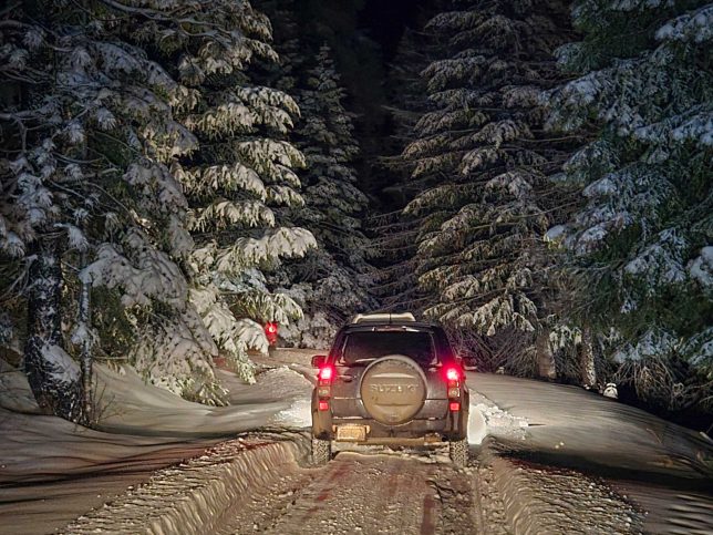
The group got together to discuss what to do next. Matt made a suggestion: leave those without range on the mountain, while vehicles that had enough fuel still would make a big fuel run. This meant going down the mountain, into town, buying fuel cans and 30 gallons worth of gas, then go back up the mountain, only to have to go back down yet again to get to camp, then into town to refuel. This would undoubtedly take all night and most of the next morning. We’d have to do the challenging snow-covered trail again not once, but three times. It was getting colder and the trail was icing up. Thankfully, the weather was forecasted to be clear. However, it was going to be cold, with a low of about 17°F. But this seemed like the best idea; perhaps the only idea that’d work to get everyone down safely.
Four Rigs To Go Back
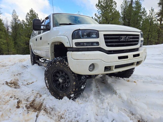
We selected four vehicles for the fuel run. This included Matt in the diesel Samurai, David the Suburban, Greg and his diesel GMC Sierra, and Mercedes and me in our diesel Delica. Between the four rigs, we had plenty of fuel, all the recovery gear, and ample capability. Frankly, we needed to be spot on and timely, too. I even said to Mercedes, “We have to be perfect. I have to do the best driving I’ve ever done.”
Before we left, everyone made sure they had what they’d need to get through the night. We handed out hand warmers, snacks, and even a dry pair of wool socks to those who’d spend the night on Wolf Mountain. We ensured they had food, water, plenty of firewood to stay warm. Again, thankfully, they had full voice/data on phones at this spot. And despite the situation, everyone was in good spirits. Hey, shit happens. None of us could’ve predicted this. Remember that bit about calculated risk? Now it was all about helping others; this was about doing good for the community.
The Great Gas Run
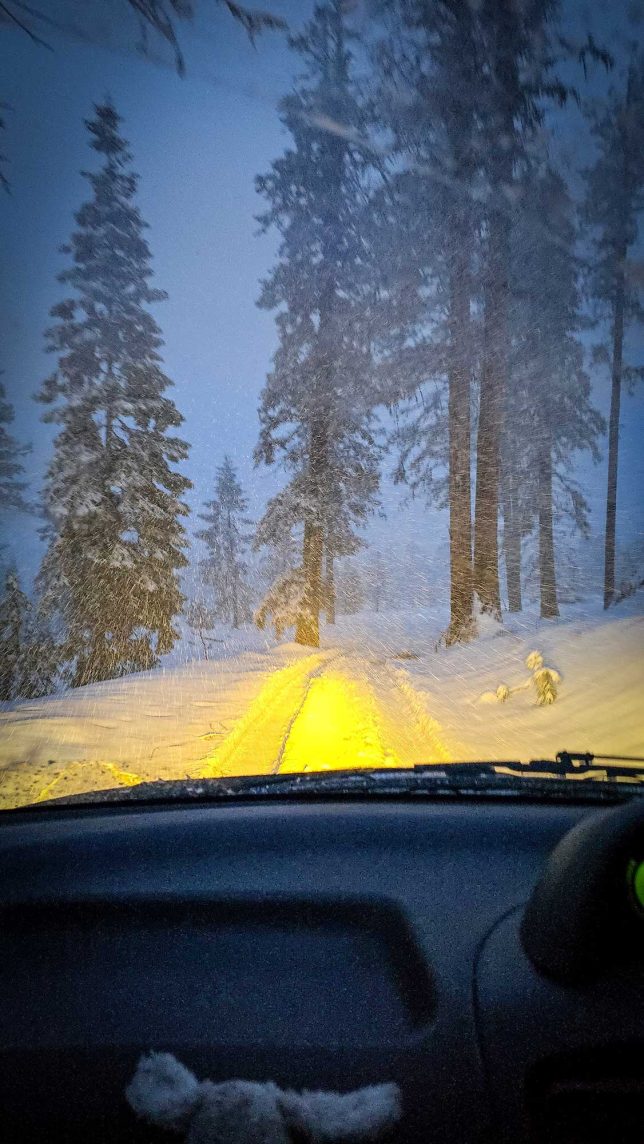
We began our journey at 8:18pm with an ascent up the back side of Wolf Mountain, but some parts of the trail were trickier than before due to changing trail conditions. We had to winch up the hill twice, and used Greg’s GMC as an anchor. David’s Suburban got hung up in a snowbank, and Greg had to pull him out, only to get himself stuck. David returned the favor and pulled him out using our Factor 55 Kinetic Rope. This all took time, but we stayed positive. Eventually, we left the snow and went back onto the twisting dirt forest service roads, and headed toward Prineville. But this was just the beginning.
Mercedes called the two 24-hour gas stations in Prineville, but there was only one two-gallon gas can between the two of them. This meant we had to go another 45 minutes one way to the Love’s truck stop in Madras, who confirmed the availability of multiple five-gallon cans. This was going to be a long night, but you do what you need to do to help others.
Lookin’ for Love’s
Back on blacktop, we had to worry about another hazard as the temperature danced around 32°F: black ice. This is when the road shows no signs of being slippery, but it’s slicker than snot on a doorknob. And yes, we all hit patches of it. We also had to worry about animals. We encountered both deer and horses on the road.
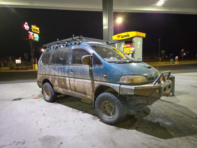
We rolled into Love’s at 2:15am, nearly six hours later, exhausted. However, we were only one-third of the way through this mission.
Eric bought five five-gallon fuel cans, and we bought the fuel. Eric also bought fuel for a few Rotopax belonging to the Ford Bronco. Between all of us, we purchased copious amounts of coffee, energy drinks, and snacks to stay awake, as we’d have another six hours or so to go until we’d get to the others.
With many milligrams of caffeine in our bloodstreams and multiple fuel cans loaded in Greg’s GMC, we started back to the trails at 2:59am. The energy drinks helped keep us going, and we stopped a few times for a 10-minute power nap to keep us awake.
Sometimes You Talk To The Universe; Sometimes The Universe Talks To You
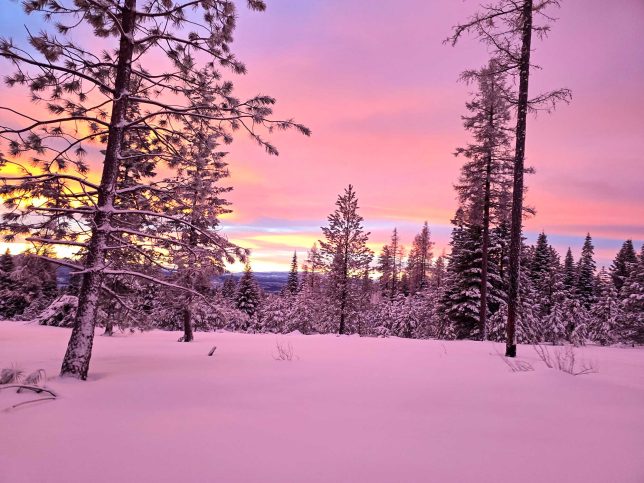
As we headed back up the mountain, the sun began to rise at 7:15am, and one of the most glorious sunrises ever illuminated the sky. Brilliant orange and pink hues painted the sky like an impressionist’s canvas. I like to say sometimes you talk to the universe, and sometimes the universe talks to you. In this instance, the sunrise was like a message to us from the heavens saying everything was going to be OK—you got this.
Arriving Back On Top
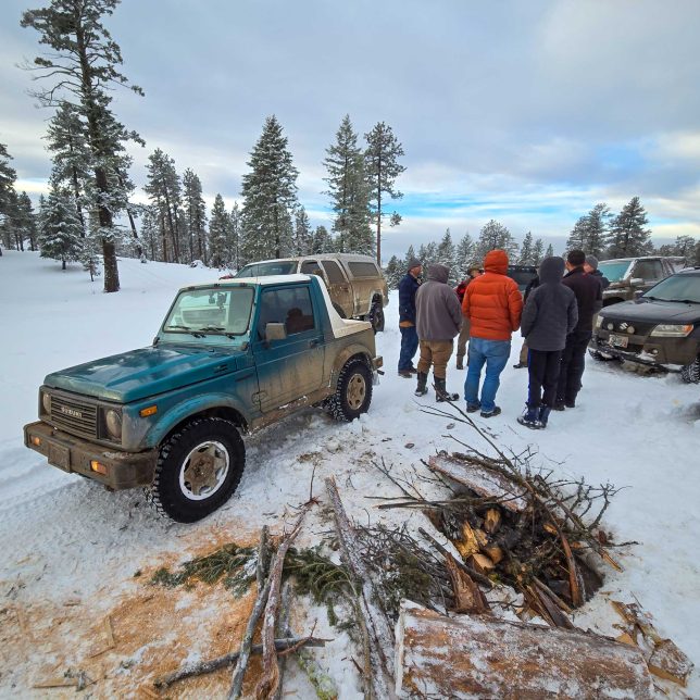
It was now 8:02am, almost exactly 12 hours since we’d left the others on the mountain. As we arrived at the makeshift mountain camp, people were happy to see us, and us to see them.
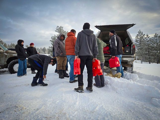
People grabbed gas cans and filled their tanks with enough fuel to get back down the mountain. But we needed to get down soon; the warmth of the sun would make the trail sloppy, slushy, and difficult. Thankfully, the trip back to camp was mostly uneventful, sans us needing to use our Maxtrax once, along with a few others needing assistance, too. I think everyone was happy to be underway again.
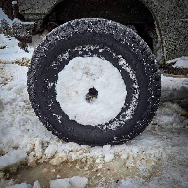
Despite what happened, people were in good spirits. We’d all come for an adventure, and that was delivered in spades. Most importantly, everyone was safe, warm, and happy. Those of us who did the fuel run were exhausted but gratetful. Some got hotel rooms in the area. Mercedes and I had a three-and-a-half-hour drive back home, so I made one last stop at Love’s to refuel the van and get a coffee for the road.
Shout out to caffeine.
A Reminder To Be Prepared
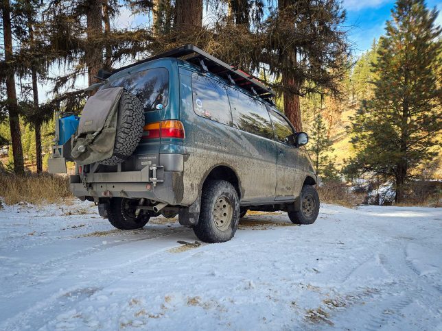
The 2024 Fall Classic ended up being one hell of a trip and gave us quite the tale to tell. Thankfully, it ended well for all parties involved, and it was a good reminder to be prepared for these situations. Bring extra supplies, recovery gear, fuel, water, food, clothes, communications (radios), etc. Make sure your vehicle is up to the task. Don’t go alone.
Every single person involved did their part. From those of us on the fuel run to the folks who stayed on the mountain—everyone remained cool, calm, and collected. No one panicked and we got the job done in the face of adversity.
This event was all about community, communication, and we all worked together. This is, after all, car culture—and it has some of the best people out there. We’ve had our fair share of breakdowns and bad luck traveling, but this wasn’t about us; this was about the group.
Undoubtedly, we’ll be back for another Fall Classic. We can’t wait—and we’ll be ready.
All in all, we spent 15 hours and 30 minutes traveling 235 miles from leaving the main group, doing the fuel run, and getting back to camp. FYI, that averages to 8.5 MPH.
Our trip total: 59 hrs., 831.4 miles (1,338 km)
When: left Friday 7am, arrived home Sunday 6pm
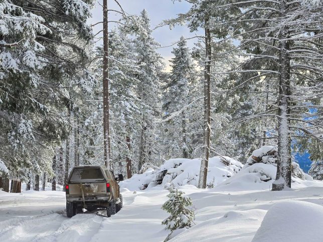

My son , grandson & nephew were part of your group & annual Fall Classic advunturists. I want to compliment the author of this wonderfully-written tale. I’d also like to compliment every one of you for staying together, staying positive & sucessfully completing this very complicated trek. Great job everyone! Here’s to next year! Sincerely grateful, Davey’s mom
I hope you guys sent notes to OnX and the other map platforms alerting them to the errors in their apps. Interesting that all three platforms were all incorrect.